Geographical Zones
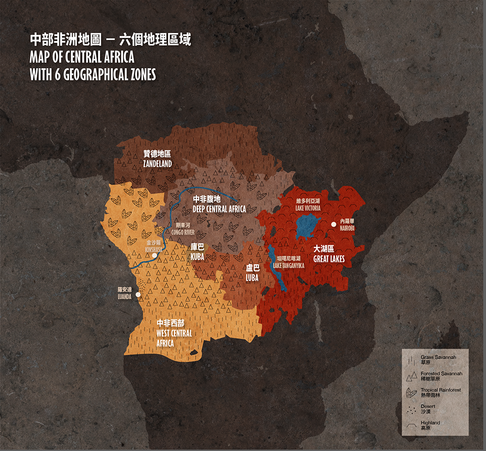
Central Africa is a vast area that encompasses the entire middle-section of the African continent, stretching from coast to coast between the Atlantic and Indian oceans. For the purpose of this exhibition, we have adopted a geographical schema dividing the region into six zones.
The northern rim of this macro region is demarcated by the sub-Saharan savannah belt. By the 19th century, this entire area had come under the control of the Zande, who had been aggressively expanding their territories for at least a hundred years. This led 19th- and early 20th-century European explorers, geographers and anthropologists to call this entire area ‘Zandeland’. To the west, the coastal region, including the old Kongo Kingdom—for centuries the most powerful, centralised state in Central Africa—and its surrounding areas, served as a centripetal force drawing the flow of goods and people from the interior, which then filtered through the Portuguese ports of Luanda and Benguela into the Atlantic.
The southern parts of Central Africa were bound by the Kuba and Luba kingdoms, which imposed political unity and some measure of cultural uniformity on a mosaic of cultural and linguistic groups. The southern parts of both Luba and Kuba territories are marked by savannahs, whereas the north is a mixture of tropical rainforest and grassland. The eastern part of Central Africa features two great lakes–Lake Tanganyika and Lake Victoria—and is geographically dominated by open, semi-arid and arid savannahs. This region has been inhabited for centuries by warlike and free-spirited pastoralists such as the Maasai.
Finally, the deep interior connects and holds all the pieces together like a giant jigsaw puzzle. Featuring mainly tropical rainforest, Deep Central Africa had been resisting political penetration from the outside world for centuries. Groups living in this area were mainly hunter-gatherers and subsistence farmers, whose fragmented and largely small-scale social organization made them vulnerable to the predation of complex states. For this reason, since at least the 16th century, such peoples had been migrating to the deep forest for refuge, and were also joined by other groups fleeing militarily aggressive powers, including the sophisticated Mangbetu; all of this considerably added to the cultural richness and diversity of the region.
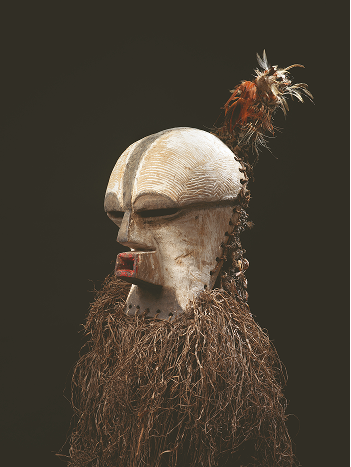
Kifwebe Female Face Mask
Cowrie shells, feather, fibre, raffia, wood
Songye, Luba Kingdom and its neighbours
Mid-20th century
Songye, Luba Kingdom and its neighbours
Mid-20th century

Highly Stylized Three-toned Bust
Pigments, wood
Tetela/Hamba, Deep Central Africa
Early 20th century
Tetela/Hamba, Deep Central Africa
Early 20th century
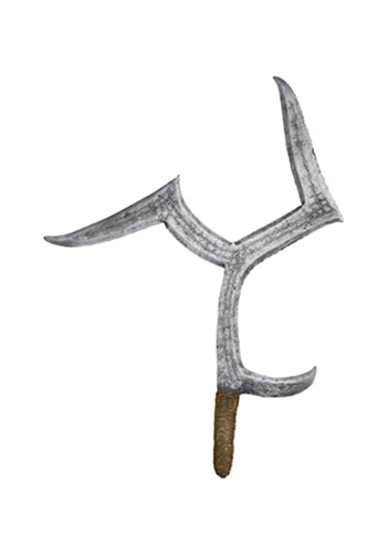
Throwing Knife
Fibre, iron
Mbanja, Zandeland
1890-1920
Mbanja, Zandeland
1890-1920
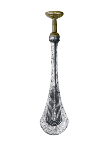
Ilwoon, Ilondo, Sword
Iron, wood
Kuba, Kuba Kingdom and its neighbours
1800-1900
Kuba, Kuba Kingdom and its neighbours
1800-1900

Shield
Leather, pigments, rattan
Masa?/Samburu/Nandi, Great Lakes Region
1900-1920
Masa?/Samburu/Nandi, Great Lakes Region
1900-1920